


Profile of a mining tunnel scanned by a rotating laser radar system. Here we have a high speed laser rad a with a rotating mirror that scanns tunel walls with sub cm accuracy. Speed is 300 KHz and output was stored in a PC for post processing. This was used for checking mine for motions in rocks to predict a collapse of the mountain. Range was 15 meter and it scanns at 50 Hz.


Helicopter with 3D lasescanner under the fuselage. It is connected with Gyros and a DGPS system to make a global point of cloud. Right image show an example of output of this device where we scanned a hydro power dam with good results and fine accuracy.


Sub sea laser radar in a paravan camera that can scan sea bed in 3D. Output is a point cloud over the scanned area. This was designed for 300 meter max depth and had a weight of 400 Kg with its heavy aluminum encapsulation. Laser was a green 532 nm laser beam that was scanned and a 3D matrix camera analyzed output and made the calculations in a PC system.


Left shows a test in a crane where we scanned a marine buoy and calculated its 3D shape. Accuracy is about 5 mm.
Right shows a test of a tube with 400 mm diameter 1 mete over sea bed. Here we have no problems to see the shape and position and all needed information an off shore sub sea application can demand. The paravan system have 5 separate ortho orientated cameras on board so we also had videos of what was measured. Customer was in North sea.


Left an obstacle detection laser radar in a rail road crossing. This was used to detect obstacles like cars between the gates to prevent accidents.
Right a laser radar with 5 Km max range used to detect path of aircrafts during tests. Here we have a thermal LWIR camea and a high speed CCD to complete laser scans.

Left a small laser radar for UAV applications. This is only 2.5 kg in weight and can reach 1500 meter in range Speed is 36 KHz an accuracy about 5 cm. Swath width is 60 degree and it makes 30 scans per second.

Right a special laser radar designed to scan electrical power lines and vegetation close to the wires. This can do up to 1500 meter in range and can see a 10 mm wire at 100 meter in distance. Output is a data base that say when vegetation is a problem and this data base is used for maintenance. Weight is 8 kg and it have an external PC for data collection and post processing.

3D scan of the famous Af Chapman tall ship in Stockholm. It was scanned at 400 meter in distance with our small 500 meter scanner. Church in back ground is 550 meter away. Speed was 3500 Hz and swat can be up to 180 degee with this small scanner. Accuracy is 5-10 cm per voxel.

Scan out of a garage over a street and away over some gardens. House is 25 meter away and most far away trees 160 meters. We see telephone cables and through vegetation well. Red marked areas are doubtful readings as reflexes disturb values even if there is something here. Note the measurement through the house window and the flower inside the glass and wall behind.


3 volumetric laser alarm system that scanns a large area to look for objects and the motion pattern they have. System scanns a dam edge 6x600 meter and can see objects as small as pedestrials moving here. Beside scanner we have a camera to show operator the scene that is scanned.


3D camera images done by an Iphone 5 and a special software that can make 3D files of a viewed area. Each voxel at right image have a 3D coordinate and a color code.
Right is same system system but we scanned a face and made it into a 3D cloud of points. face is over 300 000 voxels in data.
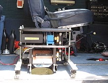
Left is a scanner system fo an UAV helicopter used to collect GIS data unmanned and automatic. Speed is 36 KHz and range 700 meter. Accuracy is 5 cm and swath scan can be adjusted to be what mission demands. This design is useable of airlifts, booats, cars etc and very flexible.
Right is a similar system in an aircraft used to make 3D GIS data collection of areas with errosion problems and environmental studies. Here we look out through a stanbdard 400 mm diameter hole earlier used for a Zeiss aerial camera system used in the past.